Russia, also known as the Russian Federation (officially) is a country in northern Eurasia. It’s the largest country in the world, covering more than one-eight of the Earth’s inhabited land area at 17,075,400 square kilometres (6,592,800 sq miles). Russia is also the world’s ninth most populous nation with nearly 144 million people in November 2014.
Geographical inconsistencies are a common source of Mandela Effects and Russia has been brought up a few times on the Subreddit.
My Experiences
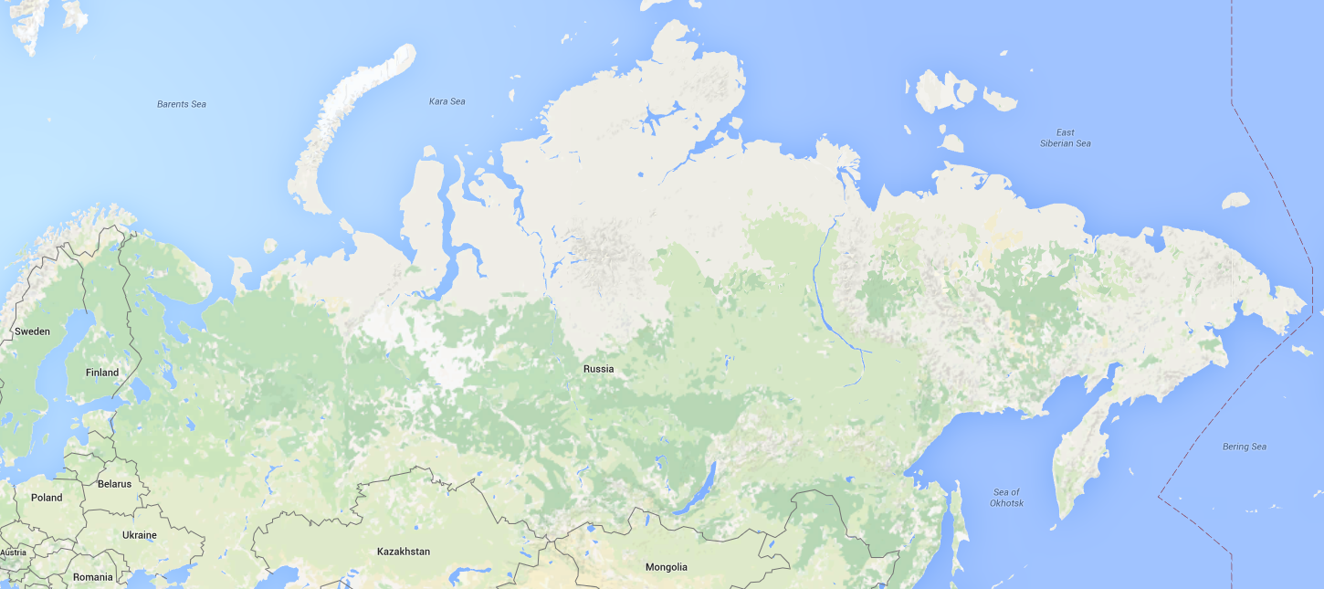
Upon looking at Russia on Google Maps, I had the initial reaction to question the shape and size of it as well. It seemed odd and different to me for some reason. I can’t say I’ve ever really focused on the size and shape of it. It was never part of geography class for me, although I would have thought I would of known it better than I did.
Possible Explanations
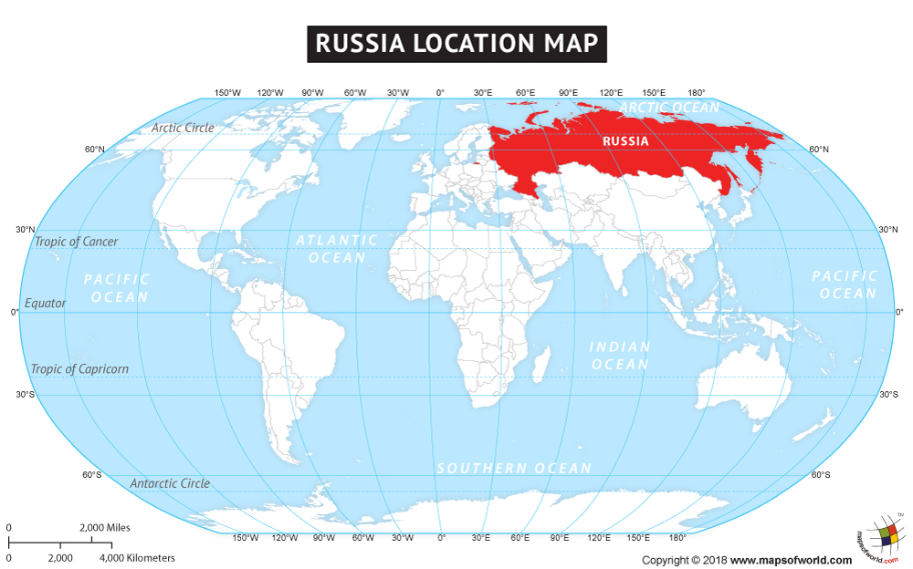
Geographical Mandela Effects can largely be debunked by map projections. Since Russia is so far north, depending on the projection, the size and shape of it can become extremely distorted as it looks on Google Maps. Compare the project used on Google Maps (Mercator) with the following done with a pseudocylindrical map projection:
Or how about this example?
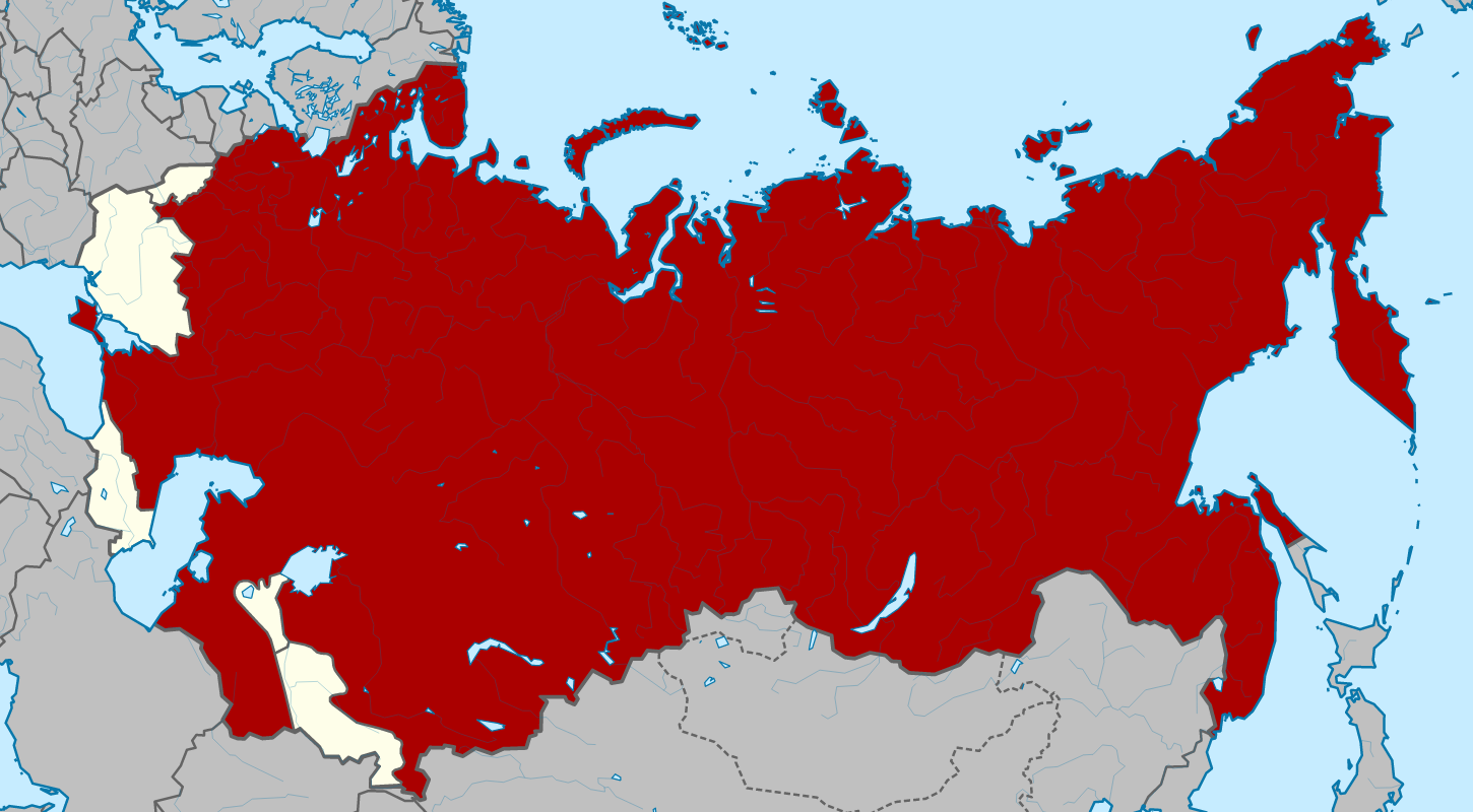
I believe this representation uses a two-point equidistant projection which makes it appear like it would on a globe. This shape may also appear even stranger since it is a representation of soviet Russia in 1922, and was much bigger compared to today’s Russia, even though, it still looks much smaller than Russia on Google. The changing of Russia’s borders may also be a possible explanation for some.
Growing up, most of us would of seen it on a globe, or perhaps on a large world map poster in a classroom which may have not used a Mercator projection. Depending on where and when you grew up, many different projections and styles have been used in classrooms around the world.
These projections look much closer to what I had in my memory. Mercator projection makes it look bloated and much more massive. It’s also inaccurate. It isn’t that big or bloated in reality which is probably why the effect is so strong even without knowing the intricacies of the Russian landmass. It just doesn’t “seem” right, and well, you’re correct.
Thank you! Right off the bat with the map references I thought the issue was likely how they “flattened” the earth for the creation of the map creating a large amount of variance from map to map.
there should be a page for south america moving a thousand miles easy and austrialia being north of New Zealand and the missing continent west of Austrailia.
It’s also possible the maps found in text books depicted North America larger than the south and Canada reflecting an ethnocentric bias. Also, a point of view directly over the center of the United States would produce a natural distortion of perspective.
here is a map from the library of congress showing the island of Newfoundland as a state. The two missing states are nova scotia and Newfoundland.
When did South America shift 500 miles to the west and the Panama canal connect from north to south! I never realized Greenland is almost as large as United States, but that is what the google maps depict. New Zealand is now cut in half and and Sweden is almost as large as Europe. What happened to the North Pole ? I guess Santa has to find a new home.
“New Zealand is now cut in half”
What happened to the North Pole ?
What are you talking about?
“I never realized Greenland is almost as large as United States”
*facepalm*
do you mean south American shifted to the EAST not the west right, s America is top heavy to the right and moved further over to the east.
I might suggest further that those of us old enough may be remembering the size and shape of the USSR. I know when I was a kid my globe still had the USSR, though Russia was, I think, outlined separately as well. I still have trouble remembering which cities are actually in countries formerly in the Soviet Union and which are in Russia itself.
I RECOGNIZE THIS IS AN OLD THREAD BUT MY HOPE IS THAT THERE STILL ENOUGH BREATH IN IT’S LUNGS TO ACCEPT THIS WORLD-SHAKING COMMENT BY THIS PLANET’S TOP THINKER AND WRITER:
DATE: AUGUST 31, 2016
TO: ARCHIE deBUNKER
FROM: CHRIS “The Train of Truth” TRAYNOR
Hey Archie!
I am not a “Grammar Nazi” or a “Spelling Cop” (that’s an “American” cop I’m referencing, by the way), however, when you host/author a site designed to debunk (and let’s face it) essentially apprise your fellow citizens the depths of their stupidity, you set yourself up for the fine-toothed comb of Avengers everywhere. In order to maintain expectations and keep the status quo (the one saying “hey, smart guy, you think you’re such a brainiac, then how come you don’t know how to spell so and so?” … the famous American display of false equivalency … a la “your facts are solid and your judgement sound but hanging that participle like you did tells me you’re dumber than every dumb person in this whole dumb world!!!”). I guess I’m supporting you and your efforts WHILE I’m gleefully chucking you under the proverbial bus by copying/pasting the following line of text from your post re: Russia:
“I would have thought I WOULD OF KNOWN it better than I did.”
It should have read “I would HAVE known it better than I did.”
Clearly, it sounds like it’s “of” in regular rat-a-tat speech but the word should be “HAVE.” You are nowhere near the first to make this mistake – in fact, I’ve been tracking the increasing use of “of” on the internet since I first saw it about 5 years ago. As someone who loves our language, and uses it all day long in a variety of (mostly) written capacities, it is far more disturbing than the other notorious string of commonplace ignorance (lose, loose, loosing, their, there, they’re, who’s, whose, affect, effect … and my personal favorite – voila! & viola!).
No need to thank me. I’m just trying to hold up our end of the bargain in the petty (tom petty) world of digital intimacy and judgement.
Stay Trumpy!
Chris “The Train of Truth” Traynor
PS – Honestly (and minus the snark), I think you’re doing a very good thing by hosting this site.
It helps keep people in check (even if there are still some Mandela Effect artifacts that bug the livin’ shit out of me … most notoriously (as a big music nerd) is the apparent “change” in lyrics found in The Mamas & The Papas huge hit song “California Dreaming” which is now being presented as sing “I pretend to play” (when the narrator “stops into a church he found along the way). Like many, I feel certain, spot-on accurate in my good, strong memory when it comes to music/lyrics etc. that the group originally sang “I BEGAN TO PRAY.”
For what it’s worth, I would like to point out that “California Dreaming” was performed (lip-synched) on the Ed Sullivan show when both the group and Mr. Sullivan were at their peak. At that cultural point in time, THERE’S JUST NO WAY THAT THE COUNTRY’S SENSIBILITIES LINED UP WITH THE CONCEPT OF “PRETENDING TO PRAY.” That would have (not “would of”) been a “freak out” lyric for CBS censors at the time (not sure, see Mick Jagger’s eye-rolling performance of “Let’s Spend The Night Together” where the network censors insisted he sing “Let’s Spend Some TIME Together” in order to appease the values of the time.
If anyone else has some thoughts on this particular, potential “Mandela Effect/Artifact” will you please contact me directly at ctraynor@whip-smart.com?
Off of, outside/inside of and other uses of of annoy me to tears.
Something is not “outside of an area” it is simply “outside an area”, where does the of come from. You can put something on the outside of something (hang your jacket on the outside of the house) but you don’t go outside of somewhere.
Get off the table should never be expressed as get off of the table, hillbilly speak. Get offa ma land, ya varmit.
Another one that is becoming intolerable is different from something. Nothing is ever different from anything. Nothing is different to anything, however.
We good, no you not, learn to speak.
It annoys the hell out of me that people who are to lazy or stupid to actually learn how the language works and how to use it effectively just claim “It don’t matter, you just a grammar cop/nazi.” It is akin to people with poor memories and a lack of education claiming, that isn’t how I remember things so the MENDELA EFFECT must be at play. NNoooooo. You just should have learned more at school, or self educated yourself a little, instead of goofing around and playing video games. The ones claiming geographical changes are my favourites at present. I can debunk the vast majority of the claims easily and irrefutably.
Actually, the examples you gave as “correct” sounded more like ‘hillbilly-speak’ to me, like you were just too lazy to include the ‘of’. If I stand in front OF the table or next TO the table – as opposed to “in front the table” or “next the table” (yee-haw!), why wouldn’t I get off OF the table? John Lennon once had a song called “Out The Blue” (well, shet mah mouth), while George Harrison had one called “Out OF The Blue” (lesser song, more eloquent title). In New Jersey, they always say “Let’s go down the shore” when they really mean “Let’s go down TO the shore” (unless they’re really planning to travel down the entire coast, like going down a list or going down a staircase). And too many people like to omit the word ‘that’ a lot. For example, someone might write “I told you I don’t like carrots” which could be corrected two different ways, depending on whether they’re reexpressing an aversion (“I told you THAT I don’t like carrots”) or repeating a quote (“I told you ‘I don’t like carrots'”). And in that example, you’ll notice that I followed up the word ‘whether’ with a choice. Some people don’t. Where they should say “I want to know whether I’ll need an umbrella OR NOT”, they’ll instead say only “I want to know whether I’ll need an umbrella.” In this case, they should have forgone using ‘whether’ in favor of using ‘if’.
I’m sorry. What were we talking about?
Is there no way to edit my post??? Damn, I typed it very quickly (my mind is extremely fertile i.e. full of shit and it just came gushing out). Well, I’ve opened myself up to all kinds of additional slings and arrows. I guess I deserve it.
FWIW, here’s the correction:
THE MAMAS & THE PAPAS lyric line should have read: I BEGAN TO PRAY (not “play”)
Also, I forgot to mention that I’m a big, loud, lousy singer of songs that I like/love and “California Dreaming” was/is one of those beloved songs. I have sung “I began to pray” countless times, so besides my normal memory “template” there’s also this auditory/vocalizing memory template reinforcing my contention that the lyrics were and are “I began to pray.”
The geographical “changes” are the easiest to debunk. Just using history, geography, climate, ecosystems and common sense, they are all out the window and in the garbage
Hey great job spreading BS! Who wants to believe facts anwyay?
Go RUSSIA! YOU FUCKIN COMMIE MOFOS!!!!
here is a map from the library of congress showing New Foundland as a state. the two missing states are newfoundland and nova scotia.
https://www.loc.gov/resource/g3823cm.gct00034/?sp=54
It wasn’t until very very recently that the most accurate mapping of earth was released. Before that various map of earth were created based on the purpose of the map or often just a glossing over of old maps. If you compare a lot of different maps from the past you will notice small differences. Also, if your trying to recall a map from memory there is no way any person will get it 100% accurate. However, since you are trying to recall it any part you don’t remember will be “created” by your mind and your mind will trick you into believing it was always that way.
In a popular mobile game, Stack the Countries (featured on The Today Show), there is a silhouette of Russia which is filled in by a much larger (accurately sized) Russia (or was in an older version at least). The shape of the silhouetted Russia is also different and I can’t remember which one was the right shape. I remember thinking it odd that they both got it right and got it wrong on the same screen.
Some people r not understanding there r no more old maps. Theyre gone… so the explanation about remapping holds no weight.
I agree with the general thrust of your argument, but the second image you linked isn’t the modern day Russian Federation but instead the historical Russian SFSR as its borders were from 1922 to 1936, when it was significantly larger than Russia is now.
Good point. Although I linked the resource and date, I failed to mention that. Will edit this!